OWASA owns 2,400 acres of forested lands, the majority of which is in the Cane Creek watershed. Cane Creek Reservoir is a main water source for the Carrboro-Chapel Hill community. Protecting the Cane Creek watershed helps safeguard water quality for the community. Sustainable forest management facilitates the protection plus provides other environmental benefits such as reducing the risk of wildfire.
Our Vision for Forest Management and Guiding Principles serve as a compass as we develop forest stewardship plans and identify actions to improve the health of our forest.
Our Forest Management Vision
Protect water quality now and for future generations by following science-based principles to manage our forest lands so they are healthy, diverse, resilient and sustainable


Community Engagement
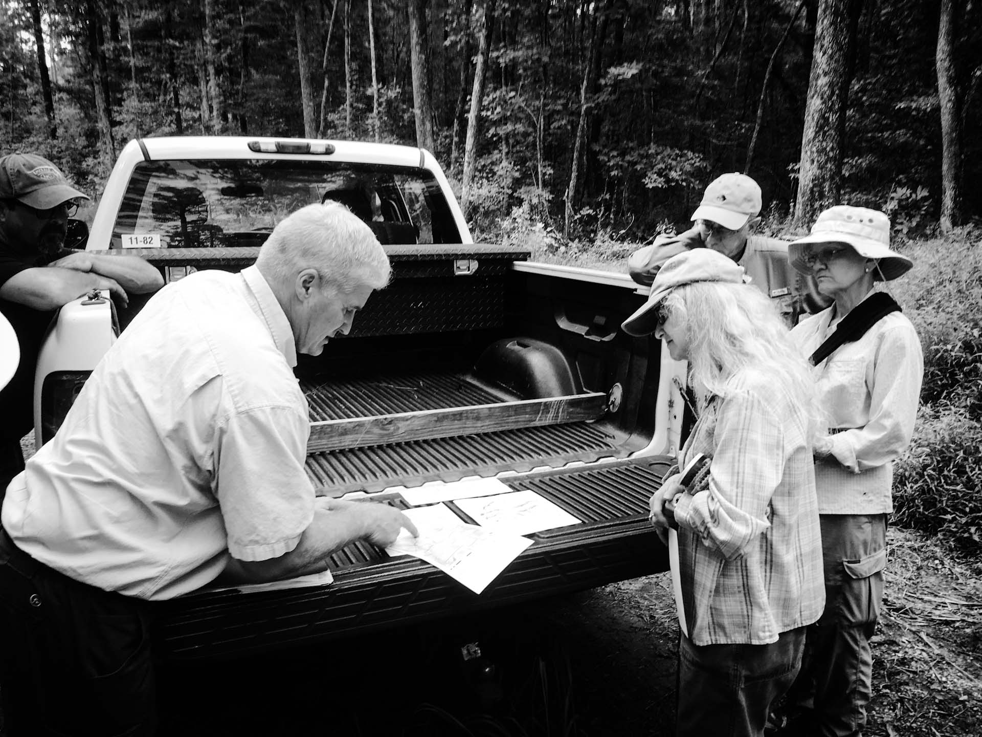
A key part of our approach is engaging with residents near our forested land to enable two-way dialogue – to garner local insights and knowledge, exchange ideas, and minimize impacts on neighboring residents – to protect the watershed together.
Sign up for email list!
OWASA’s 7 Guiding Principles For Forest Management
- Protect water quality, OWASA’s highest priority
- Improve ecological health of forested land
- Reduce the risk of wild fire
- Improve wildlife habitat and species diversity
- Sustainably manage OWASA’s resources
- Engage the community and partner agencies
- Minimize adverse impacts on neighbors and surrounding communities
Water Quality Monitoring
The US Forest Service and other agencies collected total suspended solids data on our property and five other sites in the Piedmont of North Carolina. They collected data both upstream and downstream of stream crossings; the results do not show significant differences in upstream and downstream concentrations during base flow or storm flow conditions. These results indicate that forest management best management practices help protect water quality.
Teer West Properties
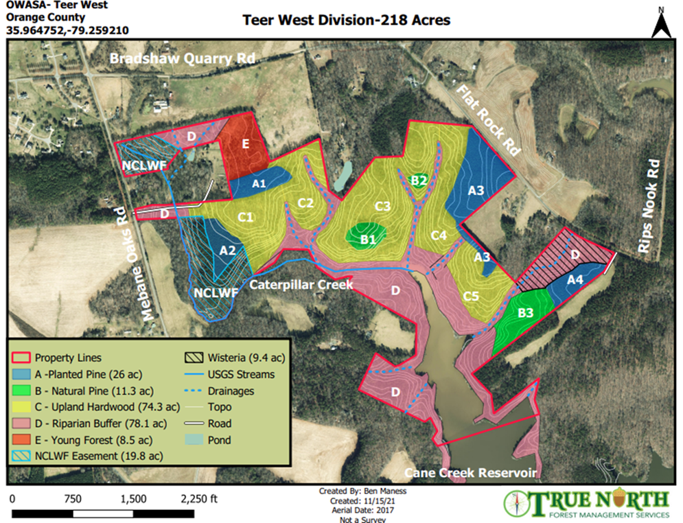
A draft stewardship plan for OWASA’s Teer West property has been developed following OWASA’s forest management guiding principles. Teer West consists of roughly 218 acres located south of Bradshaw Quarry Road and west of Flatrock Road.
CLICK HERE to sign up to receive updates regarding Teer West Forest Management activities.

The stewardship plan calls for varying levels of management depending on the unique and diverse characteristics of the property. You can also view the stewardship plan below.
Meadow Crest Properties
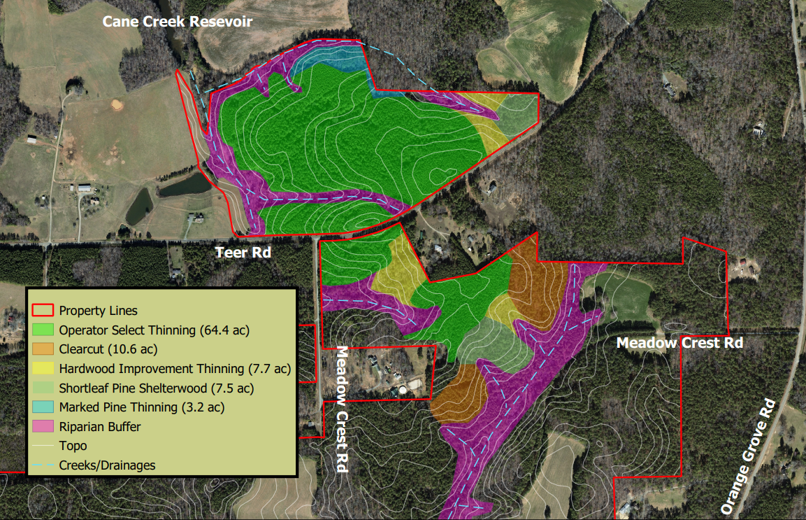
OWASA’s consultant has drafted stewardship plans for both the Meadow Crest North and Meadow Crest South properties owned by OWASA. The two properties are located on each side of Teer Road, west of Orange Grove Road, and consist of nearly 450 acres of land.

The stewardship plans call for varying levels of management depending on the unique and diverse characteristics of the property. You can also view each stewardship plan below.
CLICK HERE to sign up to receive updates regarding Meadow Crest Forest Management activities.
Working with Neighbors to Address Questions and Concerns
We reached out to neighbors near both Meadow Crest properties. We have and will work closely with them to address the following concerns.
Medical Smoke Sensitivity
In order to manage for a healthy forest, we will periodically be coordinating prescribed burns with the North Carolina Forest Service. We will work individually with medically sensitive neighbors to help ensure that adequate notice and accommodations are made.
Use of Herbicides
In some targeted areas, we will be using backpack sprayers to control invasive species and unwanted growth. There will be no large-scale broadcast application of herbicides.
Property Buffers
OWASA will consider expansion of property buffers, at the request of adjacent property owners.
Traffic and Road Repair
We will work with all contractors to ensure strict adherence to traffic safety laws and prompt road repair.
Advanced Notice of Action
We know that there may be accommodations that you need to make on your property during certain management activities. We will provide as much advance notice as possible prior to engaging in critical management activities via email.

Cane Creek Mitigation Tract
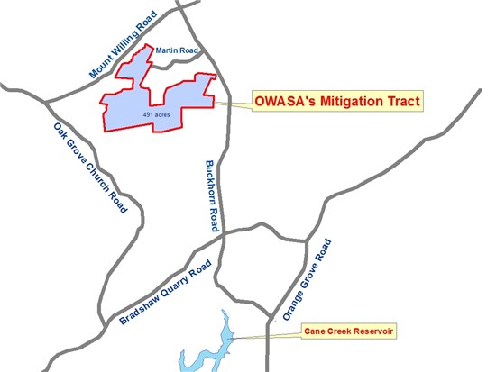
In accordance with federal requirements, OWASA is implementing a state-approved forest management plan at our 491-acre Cane Creek Reservoir Mitigation Tract near Buckhorn and Mt. Willing Rds. The goal of the plan is to protect the water quality of the streams on the site, as well as in the Cane Creek Reservoir, and to enhance wildlife habitat. The plan includes protecting 151 acres of forested buffers along streams to protect water quality and the promotion of diversity in plants and wildlife.
Since 2010, work at the mitigation tract has included thinning 225-acres to enable more robust growth of trees and improve wildlife habitat, removing a 25-acre pine area and replanting it with loblolly pines, building an earthen access road and stream crossing to support sustainable forest management activities, reseeding and stabilizing roads to prevent erosion and protect stream water quality, spreading out large piles of logs in low areas outside of streams and stream buffers to help filter sediment, and performing a prescribed burn on 24 acres near Martin Rd to maintain and restore oak at the site, benefitting wildlife and wildlife habitat.
A prescribed burn is scheduled for spring 2021 on the mitigation tract site. You can find more information in this FAQ sheet regarding the 2021 prescribed burn.


